Back to Home About

UAS Flight Operations

Aerial RF Survey · 3D Heatmaps · Telecom-Grade Data — The intersection of RF, Telecom, and Aerial Systems

Rise Above the Noise.
Who crosses an RF Engineer, Telecom Engineer, and Aerial Drone Surveyor?
ME.

At Wind & Wireless Flight Operations, we use aerial equipment to measure RF signal strength across multiple frequencies—and critically, across multiple altitudes. Our mission is to map the noise floor in 3D. Because you can't fix what you can't see. By creating a clear, altitude-aware picture of the spectrum, we give your network the data it needs to deliver clean, high-fidelity signal exactly where you need it.
$600M+ Drone RF Mapping Market (2024)
$2B+ Projected by 2033
45% of Revenue from Telecom
3D Altitude-Aware RF Heatmaps
What Is an Aerial RF Survey?

Telecom-Grade Intelligence

Most network teams guess where interference lives. They ground-truth with handheld meters, map on paper, and hope for the best. We do something fundamentally different: we fly.

We put spectrum analyzers in the air—across altitudes from 50ft to 400ft AGL—and build a 3D picture of your RF environment. We find the noise. We map the dead zones. We show you exactly where your signal is drowning—and where it can finally rise above.

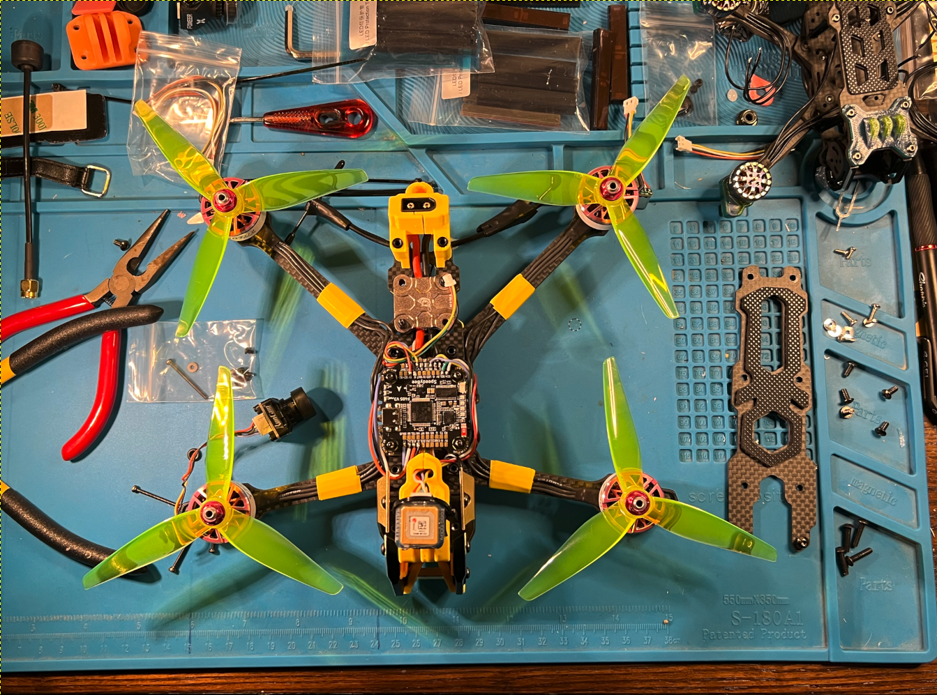
Wind & Wireless drone system on workbench
Our aerial platform: A purpose-built UAV equipped with spectrum analysis payloads, designed for multi-altitude RF data collection.
Why this matters for telecom: With 5G rollout, tower densification, and private network deployments accelerating, carriers need altitude-aware spectrum data to optimize coverage, reduce interference, and maximize ROI on every tower and small cell. Ground-level measurements miss the vertical dimension—and that's where the real signal story lives.

Why Site Inspections Are Critical for Telecom

Before You Build, Know

A new tower or small cell site is a multi-million dollar investment. The worst time to discover interference is after the concrete is poured and the radios are live.

  • Interference Mapping: Identify existing noise sources (Wi-Fi, radar, microwave links, other carriers) before you commit to a site.
  • Altitude Profiling: Understand how signal quality changes with height—critical for tower placement, antenna tilt, and power settings.
  • Predictive Validation: Confirm that your propagation models match reality. Aerial surveys give you ground-truth data before you build.
  • Regulatory Confidence: Document the RF environment to support FCC filings, zoning approvals, and neighbor disputes.
Urban utility and communication wires across city street
The urban RF environment: A dense tapestry of signals—Wi-Fi, cellular, microwave, and more. Our aerial surveys cut through the clutter to show you what's really there.
With Wind & Wireless, you get both at the same time. Our aerial surveys deliver site inspection + RF heatmapping in a single flight. We don't just tell you where to build—we show you exactly what the RF environment looks like at every altitude that matters.

The Intersection

You Are Looking for Me

There are drone pilots. There are RF engineers. There are telecom network planners.

And then there's us—the ones who speak all three languages fluently.

If you need a 3D RF heatmap that shows you exactly where your noise floor lives, across multiple altitudes and frequencies? You are looking for me.

I am excited—genuinely, boy-howdy excited—for the opportunity to fly for you. Because when your network rises above the noise, everyone hears the difference.

RF Engineering Telecom Aerial Survey 3D Heatmaps Noise Floor Mapping Multi-Altitude Data